Urban Planning & LULC Monitoring
Data-driven insights for managing urban growth, zoning, and sustainable development. Track land use change, detect informal settlements, and support data-driven planning with EO and AI.
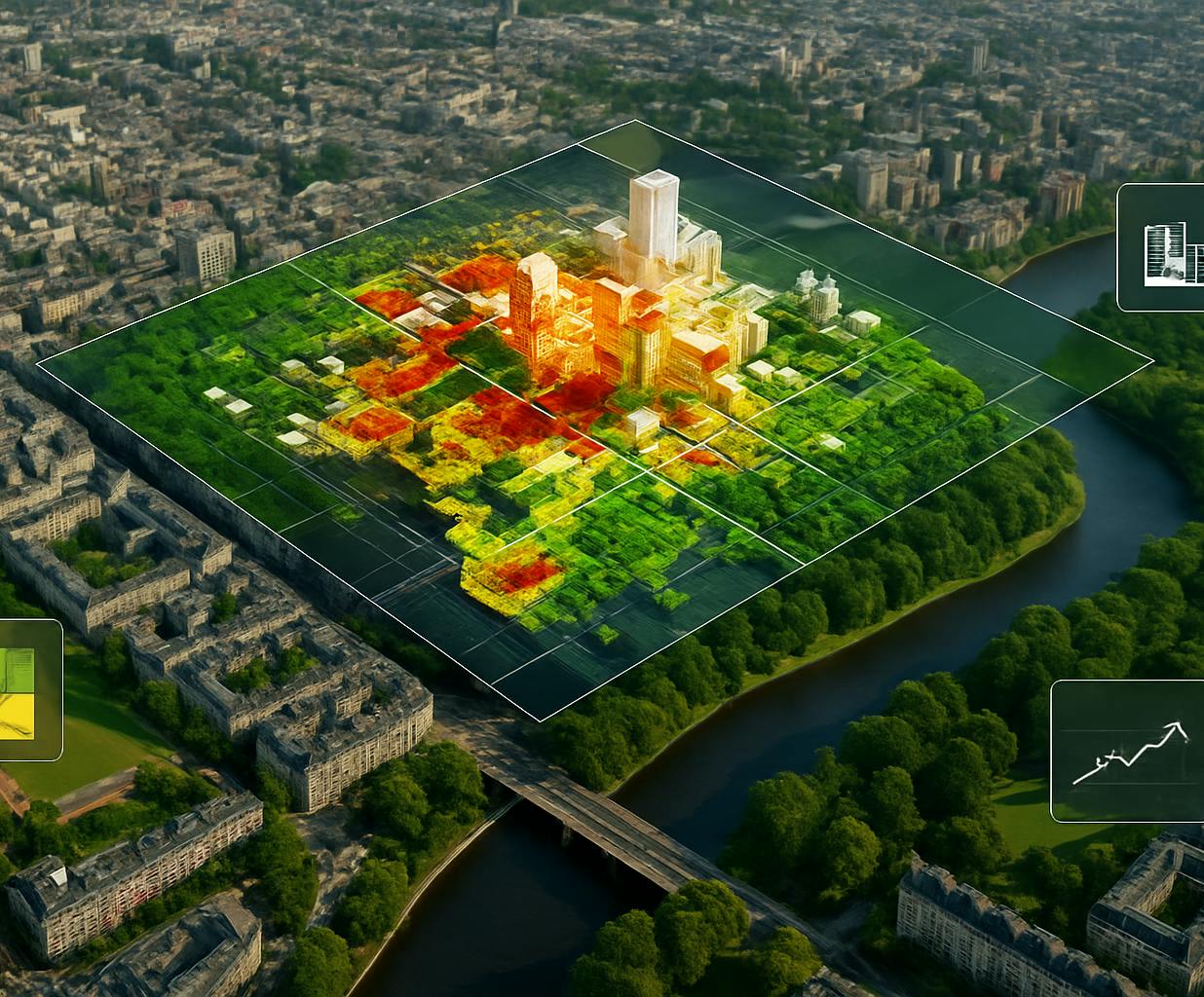
Urban areas are evolving fast. From housing expansion to green space preservation, planning decisions today shape how cities live tomorrow. With the rise of Earth Observation and AI, planners now have access to powerful tools that reveal patterns, risks, and opportunities like never before. At SPACE-SHIP, we help urban stakeholders make sense of spatial data—so growth can be smarter, fairer, and more sustainable. We collaborate with local governments, infrastructure teams, and zoning authorities to transform satellite imagery, sensor data, and machine learning into actionable guidance for land use, mobility, and development.
$161.3B
6.5%
35%

We work with local governments, urban planners, and infrastructure teams to turn satellite imagery, sensor data, and AI models into clear guidance for land use planning. Whether it's detecting informal settlements, monitoring land cover change, evaluating urban heat islands, or planning new mobility routes — we build tools that support real decisions on the ground. Our solutions combine EO data pipelines, machine learning models, and intuitive mapping interfaces to bring transparency and agility into every stage of the planning cycle.
We design customised platforms that combine multi-source EO data, LULC classification, and AI models to monitor change, guide infrastructure investment, and support compliance. From informal settlement detection to long-term land use forecasting, our tools support planning decisions grounded in evidence and built for impact.
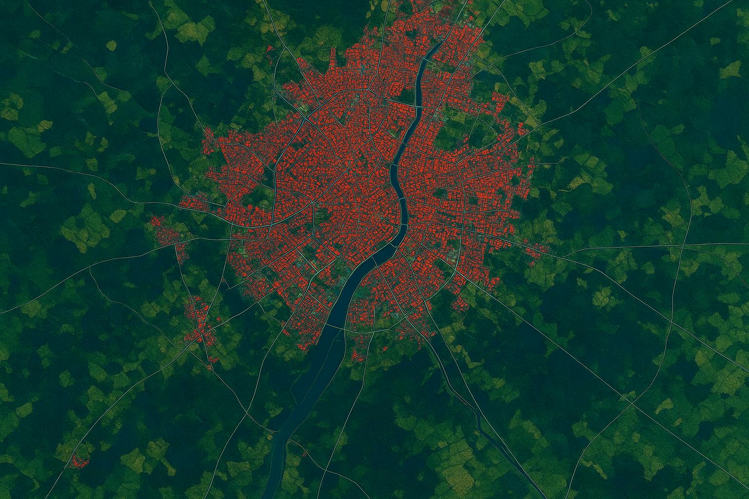
Urban Growth & Informal Settlement Mapping
Time-lapse views of expansion zones, built-up area change, and unregulated development, crucial for housing policy, service delivery, and hazard risk.
LULC Classification & Change Detection
High-resolution maps updated seasonally or annually, using EO + AI models to differentiate residential, industrial, agricultural, and natural zones.
Urban–Rural Interface & Fringe Monitoring
Detection of boundary expansion, encroachment into green or agricultural land, and pressure on peri-urban zones.
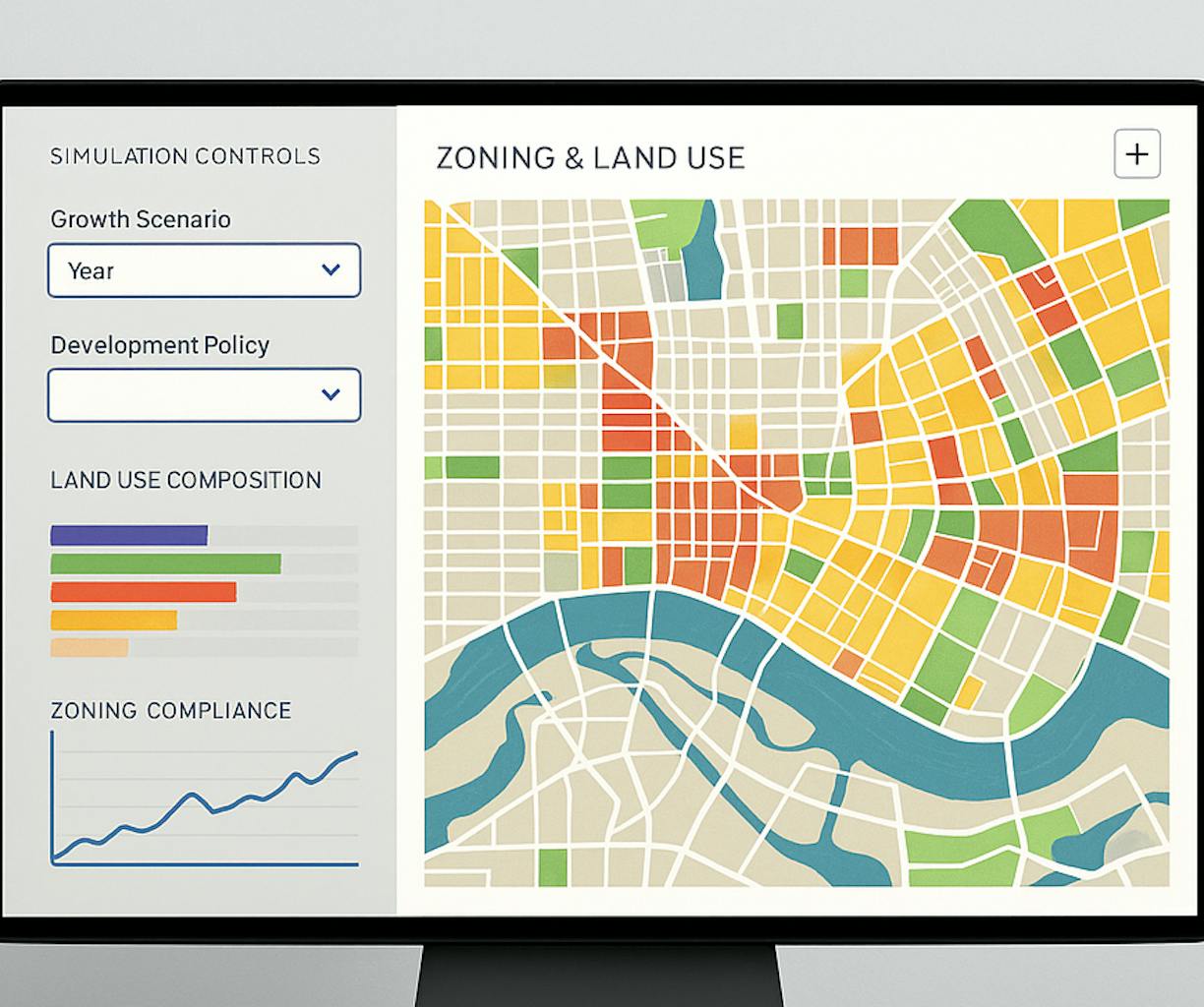
Planning Support Tools & Zoning Dashboards
Web-based platforms that visualise growth, simulate land use scenarios, and track compliance with local development plans.
Sentinel-2, Landsat, ESA WorldCover, Urban Atlas, Global Human Settlement Layer (GHSL), Google Earth Engine, Scikit-learn, PostGIS, QGIS, Dask, semantic segmentation models.