Marine Spatial Planning & Energy Transition
Smarter ocean decisions powered by EO, AI, and spatial analysis. From artificial reefs to offshore wind farms, we help identify the right sites before costly surveys begin.

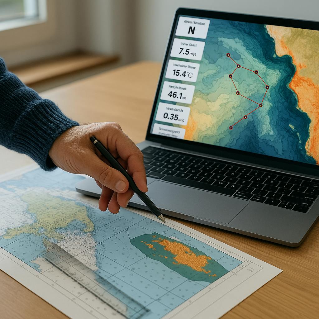
Planning activity in marine environments is complex, high-stakes, and expensive. Whether you're deploying an artificial reef, evaluating offshore wind potential, or managing conflicting uses of coastal zones, early decisions can make or break a project. At SPACE-SHIP, we help project developers, marine planners, and environmental authorities identify, screen, and prioritise marine sites using satellite data, geospatial models, and AI-powered analysis. Our solutions reduce reliance on trial-and-error, shorten timelines, and bring clarity before expensive technical surveys begin.
$25.8B
15.7%
230GW
Our team brings over a decade of cross-disciplinary experience in Earth Observation, oceanography, and marine spatial analytics. We support governments, coastal planners, and blue economy stakeholders with intelligent tools for site selection, zoning, and sustainable development. Whether it’s offshore wind siting, marine protected area planning, or artificial reef placement, we combine satellite data, environmental indicators, and regulatory layers to help you make spatial decisions that are ecologically sound, economically viable, and aligned with marine governance frameworks.
We deliver EO and data-driven decision-support tools for early-phase marine spatial planning, combining ecological, physical and human-use datasets to assess suitability and risk at scale.
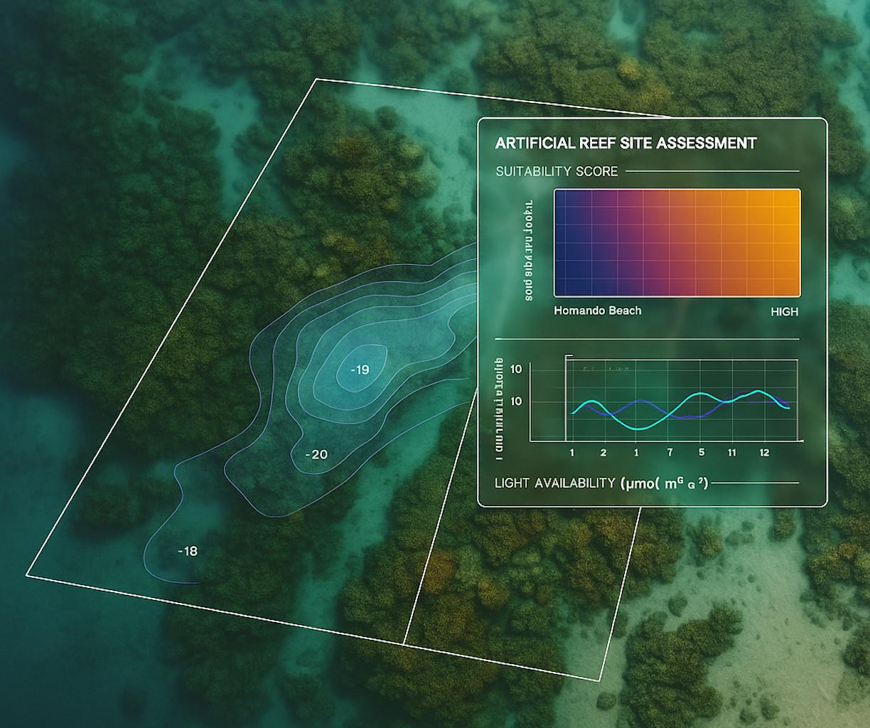
Artificial Reef Site Selection
Identify candidate locations based on bathymetry, sediment transport, ecological zones, and existing use pressures, supporting biodiversity goals and regulatory compliance.
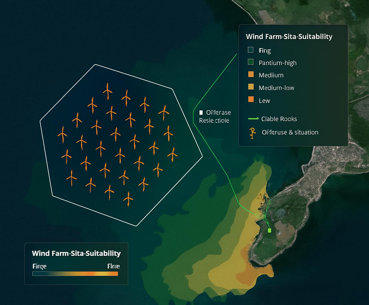
Offshore Wind & Renewable Energy Planning
Assess potential zones for wind, wave, or solar-at-sea infrastructure using EO-derived wind speed, wave height, seafloor gradient, and proximity to grid or port infrastructure.
Multi-Criteria Suitability Analysis
Integrate ecological value, logistical feasibility, exclusion zones, and risk data to generate ranked site options, customised to your objectives.
Marine Conflict & Use Mapping
Visualise overlaps between fishing zones, shipping routes, MPAs, tourism areas, and infrastructure to support transparent marine zoning and stakeholder negotiation.
Pre-Survey Site Screening Reports
Precise and accurate technical analysis for exploration, filtering, and scenario testing, designed to flag promising zones before investing in physical campaigns.
Sentinel-1/-2, CMEMS ocean data, wind & wave reanalysis (ERA5, WaveWatchIII), bathymetry (ETOPO1, GEBCO), sediment maps, AIS-derived traffic maps, Python, QGIS, PostGIS, Google Earth Engine, MCDM/MCDA frameworks.