Disaster Risk & Insurance
We support insurers and reinsurers with EO and AI for underwriting, independent claims validation, risk intelligence, and exposure analysis. Our work includes wildfire and climate-related risk assessment, parametric insurance indices, and early warning and monitoring systems.
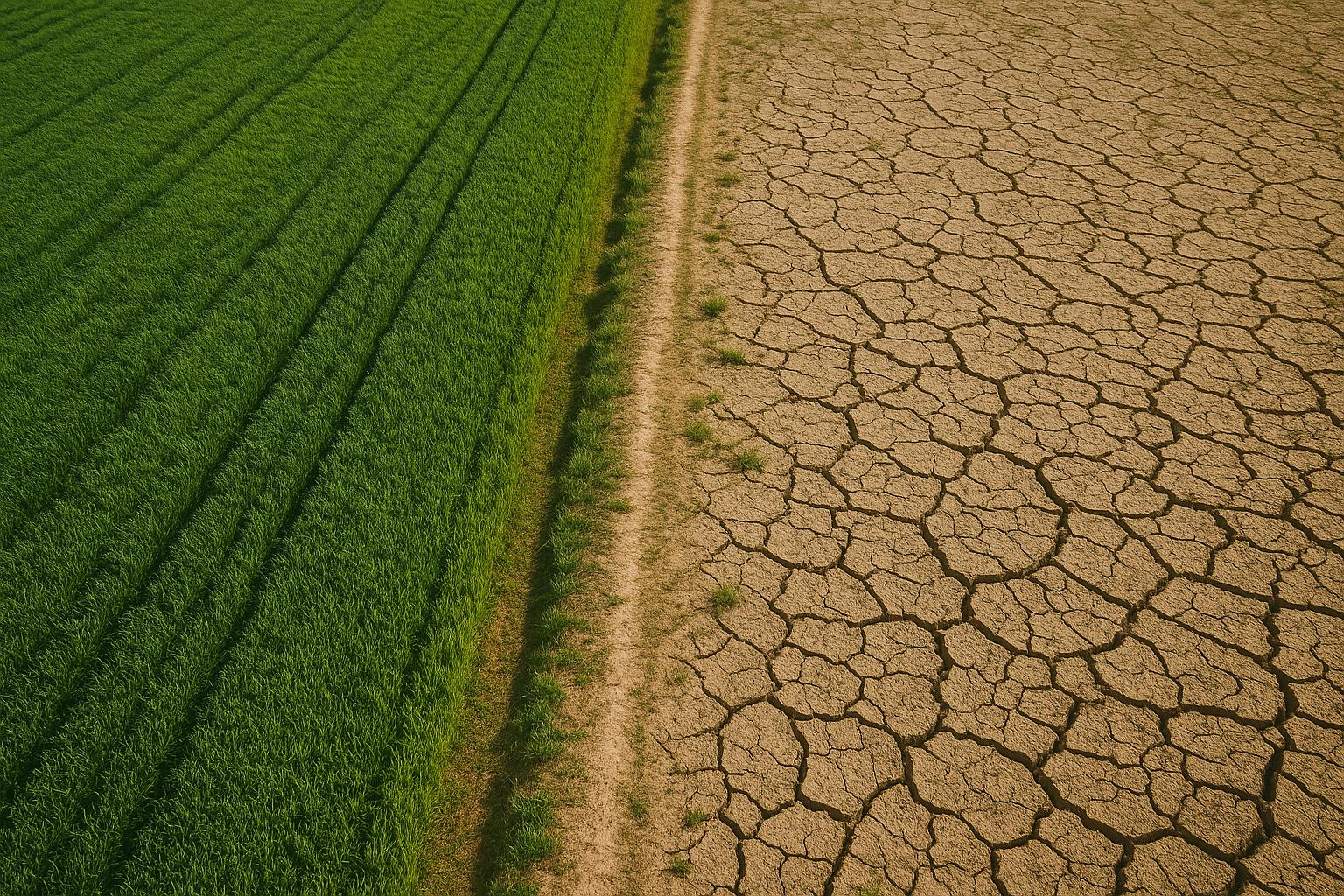
As climate and disaster risks continue to grow, insurers and reinsurers need faster, more transparent ways to assess exposure, validate claims, and respond to events. Traditional approaches often rely on delayed reporting, limited field data, and manual processes that are difficult to scale. At SPACE-SHIP, we help insurers and reinsurers use Earth Observation, AI, and geospatial data to improve underwriting, strengthen risk intelligence, support independent claims validation, and build parametric insurance products.
$14.6B
11%
40%
Our team combines deep expertise in Earth Observation, AI, remote sensing, and geospatial analysis to support insurers and reinsurers with better risk intelligence and faster decision-making. We develop tailored solutions for underwriting support, independent claims validation, parametric insurance products, climate and wildfire risk assessment, and damage analysis. Outputs can include reports, vector and raster datasets, GIS layers, dashboards, and web portals. We can also work alongside internal technical teams to improve, integrate, or scale existing systems.
We help insurers, reinsurers, and brokers build EO- and AI-powered tools for underwriting, risk monitoring, claims validation, and disaster response. Our solutions combine satellite imagery, weather data, geospatial analysis, and machine learning to provide faster, more scalable, and more transparent decision-making.

Parametric Insurance Index Design
We develop custom parametric insurance indices using remote sensing and environmental data. These can be based on rainfall, temperature, wind speed, wildfire severity, flood extent, vegetation stress, or other measurable indicators, tailored to the client, region, and risk profile.
Wildfire and Natural Disaster Intelligence
We build risk intelligence systems for wildfire, flood, storm, drought, and other natural hazards. These systems help insurers and reinsurers assess exposure, identify high-risk areas, monitor changing conditions, and improve portfolio-level risk management.
Independent Claims Validation
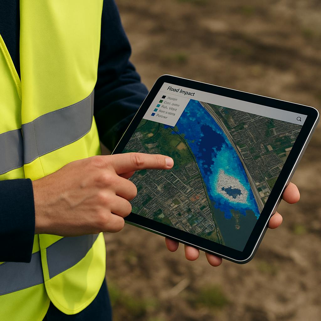
We provide independent, data-driven claims validation using satellite imagery, weather records, and geospatial analysis. This helps insurers verify whether an event occurred, assess the scale of impact, reduce fraud, and minimise the need for costly field inspections.
Post-Event Damage Assessment
We deliver rapid post-event damage assessments using pre- and post-event satellite imagery, automated change detection, and impact mapping. Outputs can include damage severity maps, affected asset counts, exposure layers, and reporting tools to support faster response and recovery.

Sentinel 1 &2, Landsat, MODIS, Copernicus Emergency Management Service (EMS), CHIRPS, National Disaster Datasets, ERA5, HydroSHEDS, SRTM, Google Earth Engine, OpenStreetMap, QGIS, Python, FastAPI.