Disaster Management & Early Warning
Real-time insight and predictive tools for risk reduction, response, and resilience. Map hazards, monitor events, and activate early warnings using EO, AI, and real-world data.
When disasters strike, every second counts. But effective prevention and response start long before a flood, landslide, or storm hits. From resilience planning to rapid damage assessment, disaster management today depends on fast, reliable, and spatially precise data. At SPACE-SHIP, we help governments, civil defence teams, and humanitarian actors build custom systems that predict, detect, and monitor disaster risks in real time. By fusing Earth Observation, weather data, and machine learning, we deliver tools that improve preparedness, speed up response, and protect lives and infrastructure.
$68.2B
12.5%
90%
Our team combines decades of experience in Earth Observation, climate science, and AI to build actionable early warning and disaster response tools. We specialize in integrating satellite data, ground intelligence, and probabilistic modelling to deliver timely, location-specific insights. From flood forecasting to post-disaster impact analysis, we design systems that help governments, humanitarian actors, and insurers act faster and smarter when every second counts.
We build end-to-end decision-support systems for disaster preparedness and emergency operations. These systems combine satellite data, historical records, and AI models to map risk zones, trigger alerts, and assess impacts across large geographies, while remaining usable and accessible to local response teams.
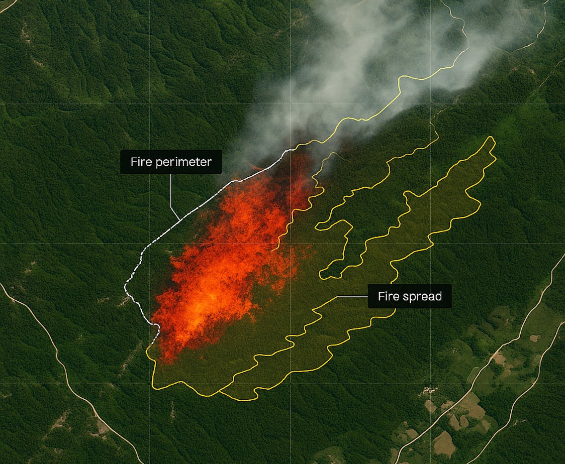
Hazard & Risk Mapping
Identify landslide-prone zones, floodplains, wildfire and coastal exposure areas using terrain, land cover, and hydrological indicators.
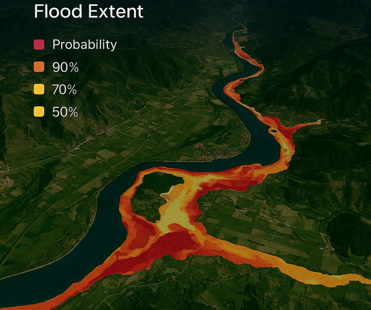
Flood Forecasting & Alert Systems
Rainfall-based prediction models, EO-derived flood extent analysis, and mobile-first alerting tools for early action and evacuation support.
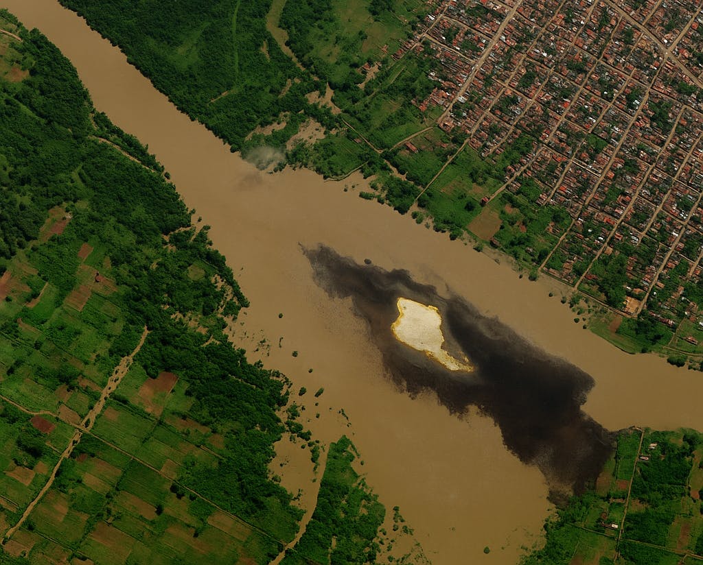
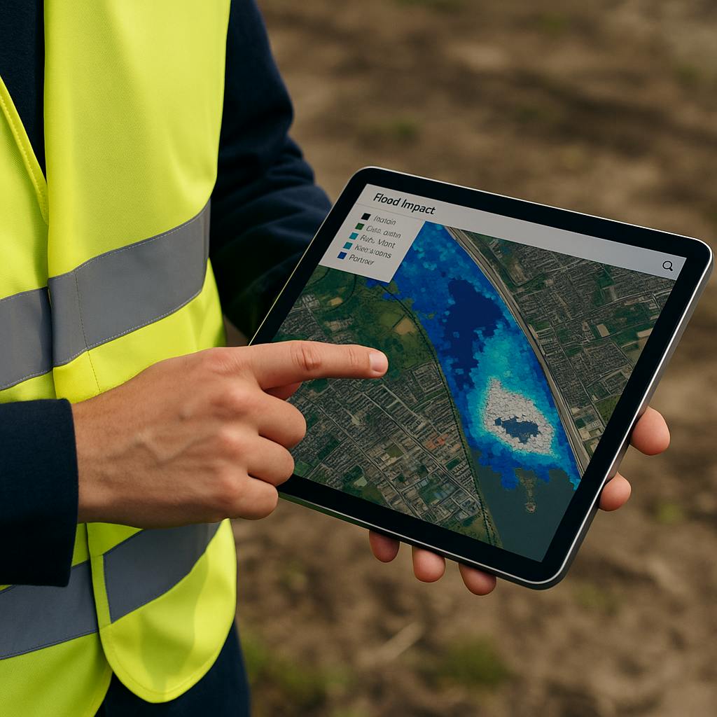
Post-Event Damage Assessment
Rapid mapping of flooded or damaged areas using pre-/post-satellite imagery, supported by automated change detection and reporting modules.
Integrated Response Dashboards
Custom platforms that integrate real-time data streams (weather, EO, river gauge sensors) with alert generation, team coordination, and civil protection protocols.
Sentinel-1 (SAR), Sentinel-2, MODIS, Copernicus Emergency Management Service (EMS), CHIRPS, ERA5, HydroSHEDS, SRTM, Google Earth Engine, OpenStreetMap, QGIS, Python, FastAPI.